CARLSBAD — The city is ramping up its efforts to better prepare for future impacts and hazards due to climate change, sea-level rise and higher-intensity storms along the coastline.
The Carlsbad City Council approved its Local Coastal Program (LCP) Land Use Plan update during its Oct. 12 meeting, which identifies rules for development, such as intensity and type.
Another component of the update is how the city tackles threats to infrastructures, such as roads, bridges, lagoons and blufftops, along with addressing concerns from homeowners and business owners, said Eric Lardy, the city’s principal planner.
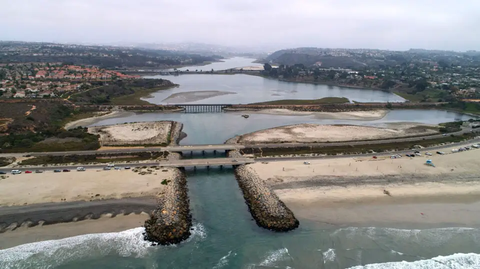
The plan covers the Coastal Zone, which ranges from the borders of Oceanside to Encinitas. The zone only covers parts of Carlsbad’s Village and Barrio neighborhoods, extending east of Interstate 5 from Tamarack Avenue south to Cannon Road and covering Aviara and a small part of La Costa, according to a city map.
“The current plan … includes the City of Carlsbad’s seal level rise vulnerability assessment,” Lardy said. “That does include an assessment of what is the hazard to Carlsbad and what are the different properties and facilities that are likely to be impacted by sea-level rise.”
While much of the Oct. 12 meeting centered on residents proposing the so-called Ponto Park, other issues were discussed, including a full realignment of Carlsbad Boulevard from the Village to the Encinitas border, a redefining of development by the California Coastal Commission and what strategies and tactics can or will be used to mitigate climate change and sea-level rise.
The city also approved a study independent of the LCP with the Scripps Institute of Oceanography through a $498,075 grant from California State Coastal Conservancy for realigning a one-mile stretch of Carlsbad Boulevard from Palomar Airport Road to Island Way.
Much of the city’s movement now stems from projections of more intense climate change and sea-level rise by 2050.
The California Coastal Commission’s approval process of the city’s LCP will take between 18 and 24 months, Lardy said. Once the commission holds a hearing, the board may not approve unless modifications are met, which could take another six months or longer.
In the meantime, the city will be conducting outreach to those inside the Coastal Zone and other residents about the city’s plan.
“All of that is really is still to be determined pending on what the Coastal Commission’s opinion is of existing (development), which they are indicating they have a different perspective than the City of Carlsbad,” Lardy said. “And what is the science and tradeoffs are potentially going to be with a balance of seawalls and a loss of beach and sand areas? There is still work to be done.”
A potential ally
Two years ago, San Diego-based Realtor Carla Farley activated her network to launch Smart Coast California, an advocacy group championing property rights and land-use policies. Farley connected with Don Schmitz, a land-use consultant and former analyst with the California Coastal Commission, to advise and connect with municipalities dealing with their respective local coastal plans.
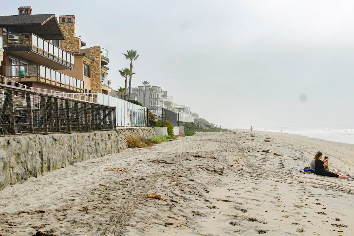
Schmitz applauded Carlsbad’s LCP during the Oct.12 meeting as forward-thinking that considers a variety of strategies, including managed retreat (or adaption strategies), beach replenishment and seawalls. Schmitz said other options, such as kelp forestation, artificial reefs and groins should also be part of the strategy, along with beach replenishment (where appropriate).
Schmitz also said Smart Coast is an ally and willing to assist the city, especially with the California Coastal Commission. (Read the full interview with Smart Coast California.)
According to both Schmitz and Farley, billions of dollars worth of infrastructure and residences — critical to the state’s economy and ethos — is at stake along the state’s coastline. Schmitz said ports will likely not have to adjust or move, but other businesses, homes and infrastructure are in jeopardy.
But perhaps the biggest battle brewing is over the Coastal Commission’s definition, or redefining, of existing development, Schmitz said.
“Removal of the definition effectively imposes managed retreat on existing property owners with structures built after the January 1, 1977, date as they would not be eligible for constructing shoreline protection devices to protect their property per Coastal Act Section 30235,” Schmitz said, referring to Santa Barbara County’s challenge of the state commission’s definition.
The city can reject the commission’s suggested modifications, according to Schmitz, and more cities are doing so. Specifically, Schmitz said each city has unique challenges and knows how best to defend its coastline.
Schmitz said residents of Half Moon Bay came out in force and the commission accepted the city’s LCP without modifications. The level of engagement from residents, businesses, the city and other stakeholders was key to the commission’s approval, Schmitz noted.
Schmitz stressed the importance of two sections of the Coastal Act where it gives authority to the local jurisdiction.
“Section 30004 (a) of the Coastal Act states: ‘To achieve maximum responsiveness to local conditions, accountability, and public accessibility, it is necessary to rely heavily on local government and local land use planning procedures and enforcement,’” Schmitz said. “Section 30500(c) of the California Coastal Act states that: ‘The precise content of each local coastal program shall be determined by the local government, consistent with Section 30501, in full consultation with the commission and with full public participation.’”
Schmitz said planning for sea-level rise is a multi-dimensional process and includes numerous measures from nature-based or “soft” solutions such as dune restoration, beach sand nourishment and artificial reefs to “hard” protection options such as groins, breakwaters, revetments, and concrete seawalls.
Artificial reefs are man-made underwater structures that are designed to imitate natural reefs and eventually lead to nature taking over.